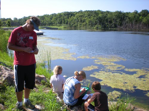
The Stormwater Geocache Challenge activity challenges students to use GPS to search Killcreek Park to find a series of caches
and complete challenges with the environmental theme of Stormwater Assessment. There is a total of 8 quests, each with a series of stormwater questions and experiments. The goal of each quest is to raise student awareness of stormwater issues and in the process do water quality testing, tree and animal track identification, site assessment, and other activities related to the scientific understanding of stormwater run-off reduction. Each team starts with a different quest route and rotates through the quest until they have completed all eight.
can be found on this website and used to supplement the lesson.
Materials
GPS unitss ( 1 for each group)
Copies of Stormwater Asssessment challenge cards
Plastic bags or waterproof containers for the cache at each site
Flags for the challenge stations - Use to identify the location of the
individual challenges, this will help each group determine what site they
are
at (if at the correct site)
A large plastic container for site 2
Identification cards for the tree and track identification stations
A bag for each group containing:
Pencils, Stormwater Assessment challenge cards, tape, scissors, small plastic
bowls,
Nitrate testing strips
Methods
Preparation (The Day before)
Determine the boundaries of your search area and then scout out the area. When
you find a good spot for a cache site, enter in the
waypoints in ALL the GPS units. (We provide a set of GPS coordinates below that can be used in
Kill Creek Park starting at Shelter House 2). Print out the cards in the attachment section at the bottom of this page (you can use 4 x 6 cards and make them into a
field notebook).
The Morning Of
Sort out materials that need to go into each ziplock bag for
the caches. Make sure you have enough for each group if they need to take
an item with them. Then put the ziplock bags at the appropriate cache sites.
Class Time
1) Talk about stormwater run-off and get kids involved by asking them what they know
about stormwater. Where does it go? Where does our drinking water come from?
2) Explain the activities for the day.
3) Explain what each group has in their bag and
what needs to be done on the index cards when they get to each cache
4) Explain what Geocaching is, and how to navigate
with a GPS unit. Test the kids on their understanding by having them find a
"test" cache point that is nearby.
5) Once the groups all understand what to do, they head
out to their first cache destination. Each group starts of at a different
cache site so they are not following each other or running into each
other.
6) If there are enough instructors you can post "experts" near the various caches to help explain the lesson. Alternatively, you can bring the groups together at the end to discuss what they found and why they may have different answers.
Suggested GPS coordinates for Kill Creek Park
|
Shelter 2
N38.54.753'
W94.58.324'
|
Site 1
N38.54.726'
W94.58.258' | Site 2
N38.54.671' W94.58.189'
|
Site 3
N38.54.773'
W94.58.294'
|
Site 4
N38.54.826'
W94.58.378'
|
Site 5
N38.54.848'
W94.58.500'
|
Site 6
N38.54.903'
W94.58.502'
|
Site 7
N38.54.844'
W94.58.540'
|
Site 8
You will need to identify places with animal tracks for this site
|


